Low Mill
Bradford Wildlife Area
Evaluation Against Local Wildlife Site Criteria Site Name/ Code: Low Mill, Addingham BWA 097 Location: Off Old Lane by the Skipton Road, SE of Addingham and NW of Ilkley
Date of Survey: 05/07/2012 Surveyor: E. Skinner,West Yorkshire Ecology
Grid Reference: SE090489 Site Area (Ha): 1.14 proposed LWS boundary (1.99 original BWA boundary)
Natural Area: Southern Pennines Public Access: to part of site
NVC Communities: A111 (Phase 1), J13 (Phase 1), W7
Site Description
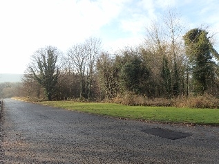
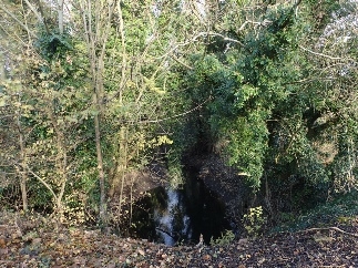
This site is located adjacent to Old Lane, which branches off the Skipton Road A65. The site was previously part of a mill and Mill Stream runs through the site from north – south and then joins the River Wharf at the southern end of the site. The River Wharf is adjacent to the eastern border of the site. There is housing by the northern end of the site, where the old mill would have been.
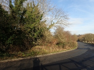
Much of Mill Stream, except the southern stretch, is bordered by wet woodland W7. Species include: frequent Acer pseudoplatanus and Fraxinus excelsior and occasional Alnus glutinosa and Ulmus glabra in the canopy, frequent Hedera helix, occasional Crataegus monogyna in the shrub layer, and occasional Dryopteris filix-mas, Phyllitis scolopendrium, Equisetum palustre, Aliaria petiolata and Geranium robertianum, locally abundant Mercurialis perennis, locally frequent Chrysosplenium oppositifolium and Caltha palustris, and rare Allium ursinum, Angelica sylvestris and Carex amara in the ground flora.
The southern stretch of the mill stream is bordered by A111 (Wood 1) semi-natural broad-leaved woodland. Species present include: occasional Acer pseudoplatanus and Fraxinus excelsior in the canopy, frequent Crataegus monogyna and rare Salix fragilis in the shrub layer. The ground flora is generally fairly sparse but contains: occasional Urtica dioica, Dactylis glomerata and locally frequent Hedera helix and Impatiens glandulifera.
A species list was also done of the wooded area alongside the River Wharf, which is outside the current site boundary. This is listed as A111 (Wood 2). Species here include: frequent Acer pseudoplatanus, occasional Ulmus glabra and rare Alnus glutinosa in the canopy, with occasional Salix fragilis and Crataegus monogyna in the shrub layer and occasional Brachypodium sylvaticum, Anthriscus sylvestris, Deschampsia cespitosa and Ranunculus repens in the ground flora.
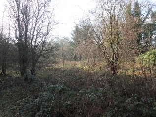
There is a field to the southern part of the site, which contains tall grassland MG1. This is fairly species poor. Recorded species include: frequent Arrhenatherum elatius, occasional Dactylis glomerata, Heracleum sphondylium, Rumex obtusifolius, Ranunculus repens, Elytrigia repens, Urtica dioica and Cirsium arvense, and rare Geranium pratense and Carex hirta.